Loading photos...
Loading mission resources...
Watch
Live coverage
Stream links and embedded coverage.
More watch links
www.youtube.comOfficial Webcast
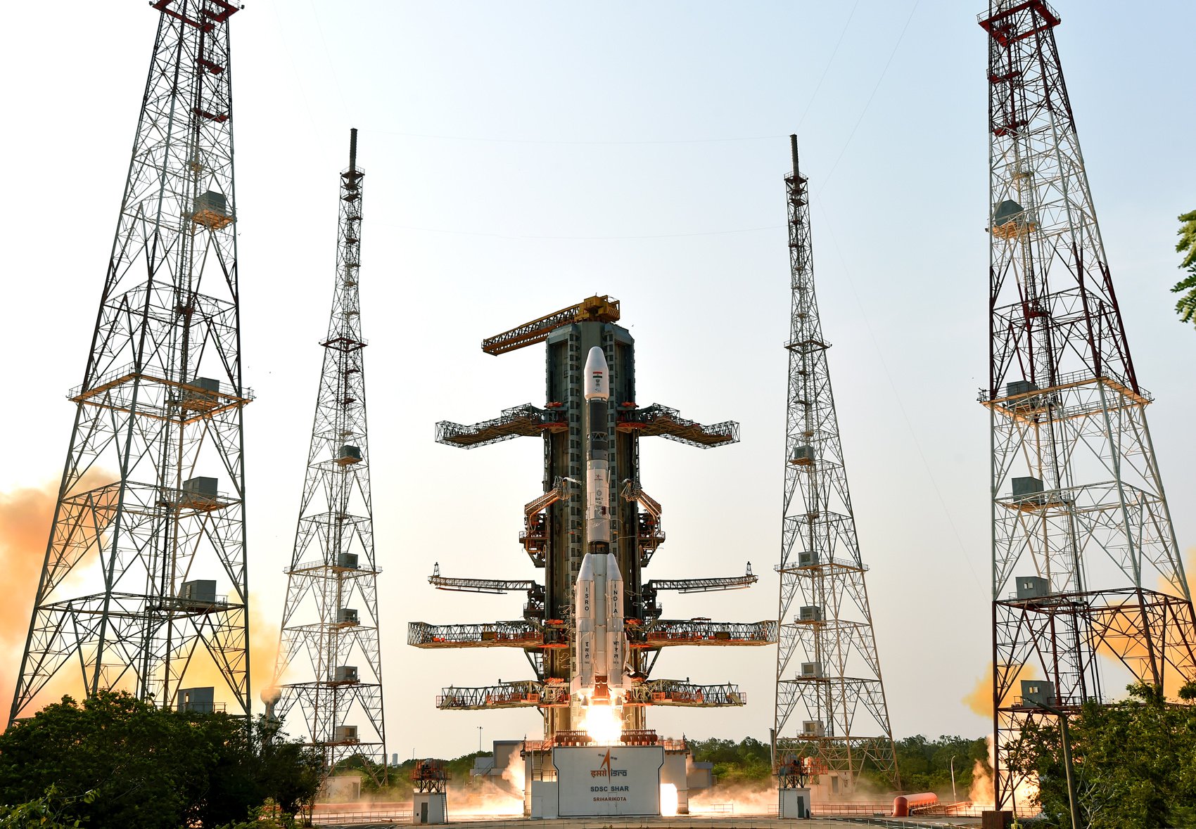
GSLV-F16 Launch with NASA-ISRO NISAR Earth Observation Satellite
TMinusZero
Loading
Preparing the latest launch data.
Launch Detail
Loading launch detail
Pulling launch timing, vehicle context, weather signals, and mission evidence.
Launch detail
Indian Space Research Organization • GSLV Mk. II • Satish Dhawan Space Centre Second Launch Pad (NA)
Indian Space Research Organization • GSLV Mk. II • Satish Dhawan Space Centre Second Launch Pad
Top answer
The NASA-ISRO Synthetic Aperture Radar, or NISAR satellite, will use advanced radar imaging to map the elevation of Earth's land and ice masses 4 to 6 times a month at resolutions of 5 to 10 meters. It is designed to observe and measure some of the planet's most complex natural processes, including ecosystem disturbances, ice-sheet collapse, and natural hazards such as earthquakes, tsunamis, volcanoes and landslid...
Last refreshed: Aug 26, 2025, 4:38 PM GMT+5:30. T-Minus Zero keeps this as the canonical launch record and reconciles schedule, mission, payload, media, and provider signals when those records are available.
Live targets are highlighted across the sequence.
Stream links and embedded coverage.
Premium keeps the launch-by-launch change log visible so you can review slips, window edits, and status changes without waiting for an error-driven upgrade prompt.
Free-to-share photography matched to this launch. Tap a photo to view it at full resolution.
The NASA-ISRO Synthetic Aperture Radar, or NISAR satellite, will use advanced radar imaging to map the elevation of Earth's land and ice masses 4 to 6 times a month at resolutions of 5 to 10 meters. It is designed to observe and measure some of the planet's most complex natural processes, including ecosystem disturbances, ice-sheet collapse, and natural hazards such as earthquakes, tsunamis, volcanoes and landslides. Under the terms of the agreement, NASA will provide the mission's L band synthetic aperture radar (SAR), a high-rate telecommunication subsystem for scientific data, GPS receivers, a solid-state recorder, and a payload data subsystem. ISRO will provide the satellite bus, an S band synthetic aperture radar, the launch vehicle, and associated launch services.
Alternate mission URLs consolidate to this canonical launch record so exact mission timing, status, media, and source context stay on one page.
Use these internal paths to move from this exact launch record into the provider, vehicle, launch-site, schedule, and mission-family pages that own broader context.
This launch currently has no dedicated mission-family hub, so provider, vehicle, site, and canonical record links are the primary internal paths.
Key structured fields for this launch record are grouped here so the page answers mission, payload, orbit, provider, source, and timing questions before the deeper tracking and media sections.
This record is preserved as historical launch context. The page emphasizes what was launched, the vehicle and pad involved, published outcome/status fields, linked programs, and source records instead of treating the mission like an upcoming countdown.
Open the launch pad in Google Maps satellite mode using the pad coordinates.
The NASA-ISRO Synthetic Aperture Radar, or NISAR satellite, will use advanced radar imaging to map the elevation of Earth's land and ice masses 4 to 6 times a month at resolutions of 5 to 10 meters. It is designed to observe and measure some of the planet's most complex natural processes, including ecosystem disturbances, ice-sheet collapse, and natural hazards such as earthquakes, tsunamis, volcanoes and landslides. Under the terms of the agreement, NASA will provide the mission's L band synthetic aperture radar (SAR), a high-rate telecommunication subsystem for scientific data, GPS receivers, a solid-state recorder, and a payload data subsystem. ISRO will provide the satellite bus, an S band synthetic aperture radar, the launch vehicle, and associated launch services.
Geosynchronous Satellite Launch Vehicle Mark II (GSLV Mk II) is the largest launch vehicle developed by India, which is currently in operation. This fourth generation launch vehicle is a three stage vehicle with four liquid strap-ons. The indigenously developed cryogenic Upper Stage (CUS), which is flight proven, forms the third stage of GSLV Mk II. From January 2014, the vehicle has achieved four consecutive successes.
The Indian Space Research Organisation (ISRO) is the space agency of the Government of India headquartered in the city of Bangalore. Its vision is to "harness space technology for national development while pursuing space science research and planetary exploration."
5ddb4403f0c3a07b8c62b6081aae66110f5d5fe908e248dfba3c068dc2e56d5cLinked via Spaceflight News API (SNAPI).
 Article
Description Data from the Earth-orbiting U.S.-India NISAR (NASA-ISRO Synthetic Aperture Radar) satellite’s L-band radar was used to produce an image of Nunat...
 Article
As of July 20, the public can access data from the two powerful radar instruments aboard the NISAR (NASA-ISRO Synthetic Aperture Radar) satellite. Teams in t...
Provider, rocket, pad, and booster history tied to this launch.