

Cape Canaveral, FL, Monday, August 10, 2026 Local
Expiredambiguousconfidence 50%6/2785
1 shape
FL
Window
Aug 10, 2026, 9:00 AM GMT+9 to Aug 11, 2026, 9:00 AM GMT+9
Details
ZJX • SPACE OPERATIONS
TMinusZero
Loading
Preparing the latest launch data.
Launch Detail
Loading launch detail
Pulling launch timing, vehicle context, weather signals, and mission evidence.
Launch detail
Mitsubishi Heavy Industries • H3-22 • Yoshinobu Launch Complex LP-2 (JP-46)
Top answer
QZSS (Quasi Zenith Satellite System) is a Japanese satellite navigation system operating from inclined, elliptical geosynchronous orbits to achieve optimal high-elevation visibility in urban canyons and mountainous areas. The navigation system objective is to broadcast GPS-interoperable and augmentation signals as well as original Japanese (QZSS) signals from a three-spacecraft constellation. The navigation system...
Last refreshed: Aug 11, 2026, 7:36 AM GMT+9. T-Minus Zero keeps this as the canonical launch record and reconciles schedule, mission, payload, media, and provider signals when those records are available.
Live targets are highlighted across the sequence.
Stream links and embedded coverage.
Premium keeps the launch-by-launch change log visible so you can review slips, window edits, and status changes without waiting for an error-driven upgrade prompt.
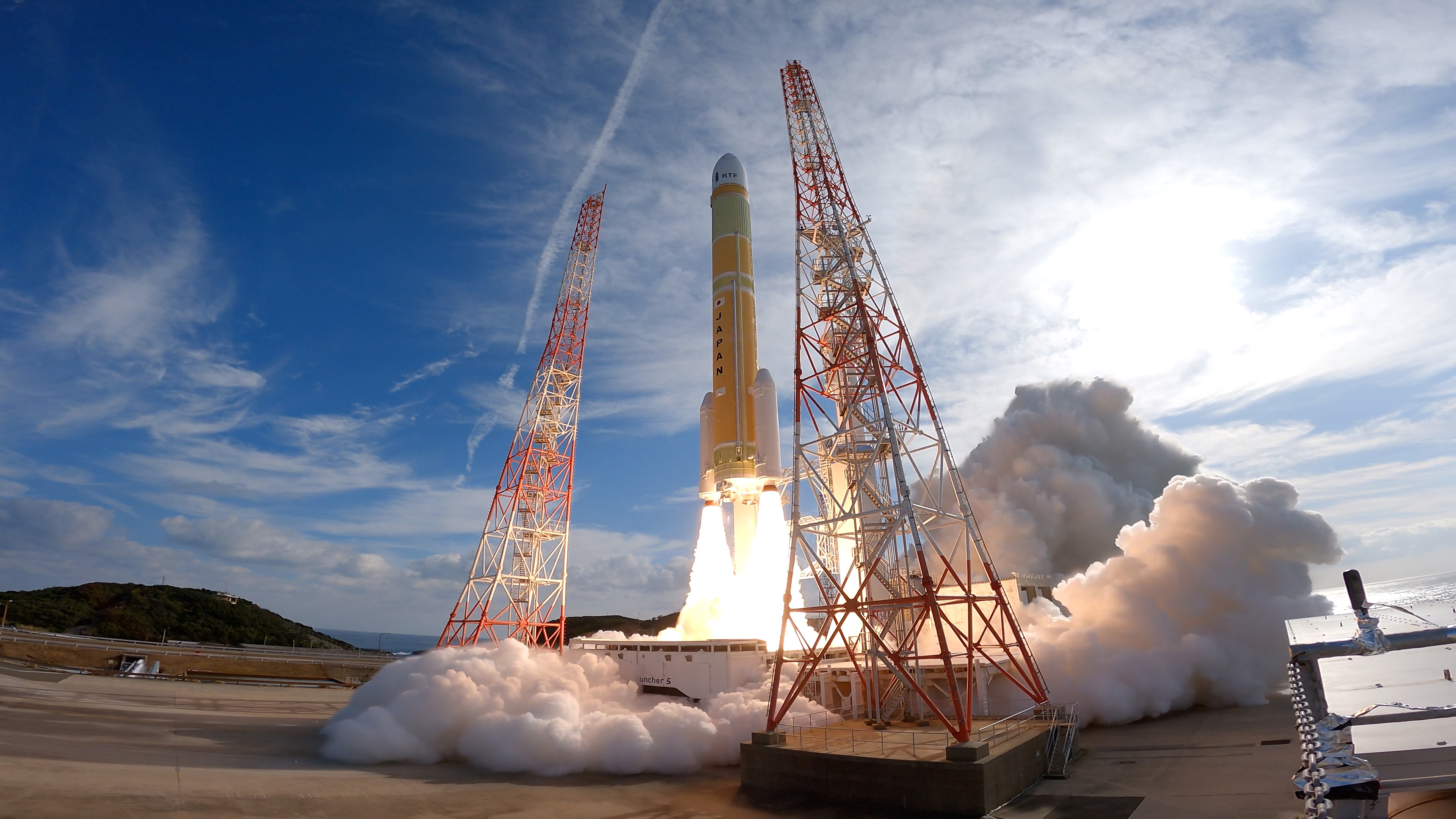
Free-to-share photography matched to this launch. Tap a photo to view it at full resolution.
 QZS-5 to 7 Patch
Linked via Spaceflight News API (SNAPI).
 Article
The Aug. 10 launch of QZS-7 completes bilateral program to host U.S. sensors aboard Japanese navigation satellites The post U.S. Space Force adds second sur...
 Article
A Japanese H3 rocket successfully launched a navigation satellite Aug. 10, more than seven months after a similar launch ended in failure. The post H3 launc...
 Article
The week of Aug. 10 opened with an extraordinary Monday, four launches across three countries… The post Launch Preview: Chinese failure opens busy internati...
 Article
The U.S. Space Force announced May 17 it has delivered the second of two payloads to be hosted on Japanese satellites under an agreement the United States si...
QZSS (Quasi Zenith Satellite System) is a Japanese satellite navigation system operating from inclined, elliptical geosynchronous orbits to achieve optimal high-elevation visibility in urban canyons and mountainous areas. The navigation system objective is to broadcast GPS-interoperable and augmentation signals as well as original Japanese (QZSS) signals from a three-spacecraft constellation. The navigation system objective is to broadcast GPS-interoperable and augmentation signals as well as original Japanese (QZSS) signals from a three-spacecraft constellation in inclined, elliptical geosynchronous orbits.
Alternate mission URLs consolidate to this canonical launch record so exact mission timing, status, media, and source context stay on one page.
Use these internal paths to move from this exact launch record into the provider, vehicle, launch-site, schedule, and mission-family pages that own broader context.
This launch currently has no dedicated mission-family hub, so provider, vehicle, site, and canonical record links are the primary internal paths.
Key structured fields for this launch record are grouped here so the page answers mission, payload, orbit, provider, source, and timing questions before the deeper tracking and media sections.
This record is preserved as historical launch context. The page emphasizes what was launched, the vehicle and pad involved, published outcome/status fields, linked programs, and source records instead of treating the mission like an upcoming countdown.
Open the launch pad in Google Maps satellite mode using the pad coordinates.
QZSS (Quasi Zenith Satellite System) is a Japanese satellite navigation system operating from inclined, elliptical geosynchronous orbits to achieve optimal high-elevation visibility in urban canyons and mountainous areas. The navigation system objective is to broadcast GPS-interoperable and augmentation signals as well as original Japanese (QZSS) signals from a three-spacecraft constellation. The navigation system objective is to broadcast GPS-interoperable and augmentation signals as well as original Japanese (QZSS) signals from a three-spacecraft constellation in inclined, elliptical geosynchronous orbits.
The H3 Launch Vehicle is a Japanese expendable launch system. Each H3 booster configuration has a two-digit and a letter designation that indicates the features of that configuration. The first digit represents the number of LE-9 engines on the main stage, either "2" or "3". The second digit indicates the number of SRB-3 solid rocket boosters attached to the base of the rocket, and can be "0", "2" or "4". All layouts of solid boosters are symmetrical. The letter in the end shows the length of the payload fairing, either short "S" or long "L". For example, an H3-24L has two engines, four solid rocket boosters, and a long fairing, whereas an H3-30S has three engines, no solid rocket boosters, and a short fairing.
Mitsubishi Heavy Industries, Ltd. is a Japanese multinational engineering, electrical equipment and electronics company headquartered in Tokyo, Japan. MHI is one of the core companies of the Mitsubishi Group. MHI's products include aerospace components, air conditioners, aircraft, automotive components, forklift trucks, hydraulic equipment, machine tools, missiles, power generation equipment, printing machines, ships and space launch vehicles. Through its defense-related activities, it is the world's 23rd-largest defense contractor measured by 2011 defense revenues and the largest based in Japan.
Provider, rocket, pad, and booster history tied to this launch.
Temporary flight restrictions and NOTAM matches tied to this launch.
Advisory data is informational. Confirm operational constraints with official FAA publications.
A launch-area reference planning index. Use your location for a viewpoint-specific result.
Some parts of the visibility chain line up at the launch area, but at least one important factor is limiting the view.
This is a planning index, not a percent chance. Higher means the modeled viewing setup is stronger.
If needed, your browser asks permission only after you choose this. The launch-area result is not a forecast for your viewpoint.
This score uses a modeled ascent corridor rather than an exact mission path. The overall viewing setup remains useful; direction and timing are approximate.
This outlook evaluates whether a broad, sunlit ascent plume could stand out. It does not yet predict whether a specific vehicle will produce one, and an unfavorable plume outlook does not mean the rocket itself will be invisible.
Read the jellyfish effect and JEP FAQ
Did you see a jellyfish-style plume from this viewpoint?