
Loading photos...
Loading mission resources...
Loading related events...
Loading vehicle timeline...
Loading related news...
TMinusZero
Loading
Preparing the latest launch data.
Launch Detail
Loading launch detail
Pulling launch timing, vehicle context, weather signals, and mission evidence.
Launch detail
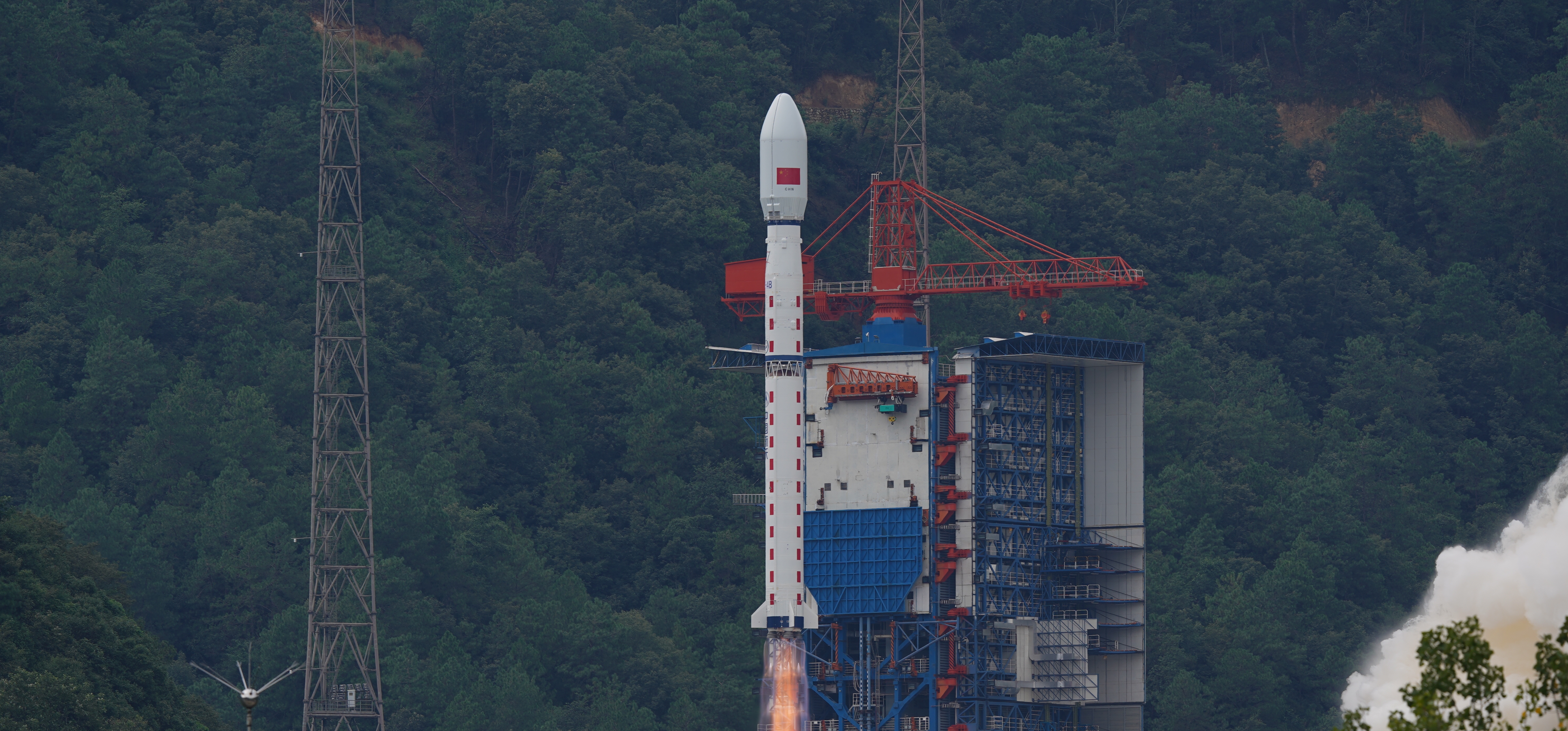
China Aerospace Science and Technology Corporation • Long March 4B • Launch Complex 9 (CN-SX)

China Aerospace Science and Technology Corporation • Long March 4B • LC-9
Top answer
The ZY-3 (Ziyuan-3, 'Resource-3') series represents China's first high-resolution, stereoscopic mapping satellites for civilian use. The second satellite is managed by the Satellite Surveying and Mapping Application Center (SASMAC). The imaging payload consists of a three-line camera array and a multispectral imager. The three-line panchromatic camera array to acquire stereoscopic imagery consists of three telesco...
Last refreshed: Dec 17, 2025, 6:59 AM GMT+8. T-Minus Zero keeps this as the canonical launch record and reconciles schedule, mission, payload, media, and provider signals when those records are available.
Premium keeps the launch-by-launch change log visible so you can review slips, window edits, and status changes without waiting for an error-driven upgrade prompt.
Free-to-share photography matched to this launch. Tap a photo to view it at full resolution.
 CZ-4B Ziyuan-3-04
Linked via Spaceflight News API (SNAPI).
 Article
Global launch activity is set to surge over the next week, with 13 missions scheduled… The post Launch Roundup: Ariane 6, Falcon 9, Atlas V, and Electron la...
 Article
China conducted a pair of launches in recent days, sending a commercial cargo spacecraft and tech demo into orbit, followed by a remote sensing satellite. T...
The ZY-3 (Ziyuan-3, 'Resource-3') series represents China's first high-resolution, stereoscopic mapping satellites for civilian use. The second satellite is managed by the Satellite Surveying and Mapping Application Center (SASMAC). The imaging payload consists of a three-line camera array and a multispectral imager. The three-line panchromatic camera array to acquire stereoscopic imagery consists of three telescopic cameras with one oriented to the nadir and the other two each offset by 22° forward and backward in flight direction. The stereo mapping camera of ZY-3 has a resolution of 2.1 m for the nadir camera, and 2.6 m for the offset cameras. The swath width is 51 km. The multispectral imager for environmental and vegetation monitoring consists of a three-mirror telescope and a cooled detector system sensitive to four wavelength bands to capture full-color imagery as well as near-infrared data. The ground resolution of this system is 5.8 m.
Alternate mission URLs consolidate to this canonical launch record so exact mission timing, status, media, and source context stay on one page.
Use these internal paths to move from this exact launch record into the provider, vehicle, launch-site, schedule, and mission-family pages that own broader context.
This launch currently has no dedicated mission-family hub, so provider, vehicle, site, and canonical record links are the primary internal paths.
Key structured fields for this launch record are grouped here so the page answers mission, payload, orbit, provider, source, and timing questions before the deeper tracking and media sections.
This record is preserved as historical launch context. The page emphasizes what was launched, the vehicle and pad involved, published outcome/status fields, linked programs, and source records instead of treating the mission like an upcoming countdown.
Open the launch pad in Google Maps satellite mode using the pad coordinates.
The ZY-3 (Ziyuan-3, 'Resource-3') series represents China's first high-resolution, stereoscopic mapping satellites for civilian use. The second satellite is managed by the Satellite Surveying and Mapping Application Center (SASMAC). The imaging payload consists of a three-line camera array and a multispectral imager. The three-line panchromatic camera array to acquire stereoscopic imagery consists of three telescopic cameras with one oriented to the nadir and the other two each offset by 22° forward and backward in flight direction. The stereo mapping camera of ZY-3 has a resolution of 2.1 m for the nadir camera, and 2.6 m for the offset cameras. The swath width is 51 km. The multispectral imager for environmental and vegetation monitoring consists of a three-mirror telescope and a cooled detector system sensitive to four wavelength bands to capture full-color imagery as well as near-infrared data. The ground resolution of this system is 5.8 m.
The Long March 4B (Chinese: 长征四号乙火箭), also known as the Chang Zheng 4B, CZ-4B and LM-4B is a Chinese orbital carrier rocket. Launched from Launch Complex 1 at the Taiyuan Satellite Launch Center, it is a 3-stage rocket, used mostly to place satellites into low Earth and sun synchronous orbits.
The China Aerospace Science and Technology Corporation (CASC) is the main contractor for the Chinese space program. It is state-owned and has a number of subordinate entities which design, develop and manufacture a range of spacecraft, launch vehicles, strategic and tactical missile systems, and ground equipment. It was officially established in July 1999 as part of a Chinese government reform drive, having previously been one part of the former China Aerospace Corporation. Various incarnations of the program date back to 1956.
8063ed195b814923592f44b415a48d8abdaef43d99a8c9e92de1e20360ad90abProvider, rocket, pad, and booster history tied to this launch.